
CENTRAL ANTI-ATLAS TRAVERSE: the northern border of the West African Craton
By DR. M. OUKASSOU, DR. H. EL HADI, DR. F. HAISSEN, DR. N. SABER
ITINERARY and OBJECTIVES
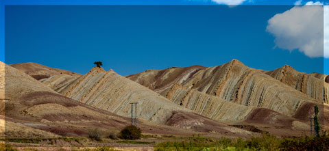
The south of Morocco is one of the most attractive touristic areas with diversified landscapes from snowy mountains to desert plains. The High Atlas with his 3000 to 4000 meters forms a major climatic barrier to the Atlantic perturbations, which account for the arid climate of the Anti Atlas sub Saharan domain south of the chain. These regions are occupied by berbere speaking populations with long hospitality tradition.
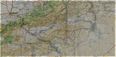
The two day trips follow most touristic roads and visit outstanding outcrops illustrating a central transect across the Anti-Atlas belt (figures G1 & G2), which corresponds to the external fold belt of the Hercynian (Variscan, Alleghanian) chain, but it also includes large Pan African inliers. The High Atlas formed during the Cenozoic at the expense of an aborted Triassic Jurassic rift. Therefore, three superimposed Wilsonian cycles can be illustrated during the trips. The itinerary will make possible to illustrate the complex geological history of these areas from 2 Ga to present day. Our purpose is to present and discuss various regional and thematic (sediment logical, structural, magmatic and
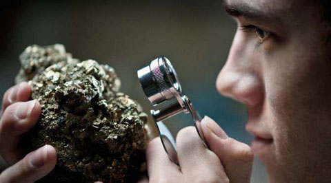
metamorphic) features, which record the main geodynamical events during this long geological history. Magnificent minerals (erhytrite, vanadinite...) and fossils (trilobites, goniatites...) can be purchased at many places.
During this field trip, the AgdzBou Azzer Tazenakht Agdzloop (figureG3)allows the participants to discover the PanAfrican belt (external platform domain in the Zenaga inlier, ophiolitic suture zone at Bou Azzer), the early volcano clastic cover sequence (late Neoproterozoic), and the mildly folded Early Paleozoic sediments (Cambrian and Ordovician).
Detailed road log for the trip are provided below along with Global Positioning Satellite (GPS) location at each stop. Note that all the stops are on public roads, and that the use of hammers and the collection of rocks are permitted.


Source web: DR. M. OUKASSOU, DR. H. EL HADI, DR. F. HAISSEN, DR. N. SABER sociedadgeologica.es
Les articles en relation
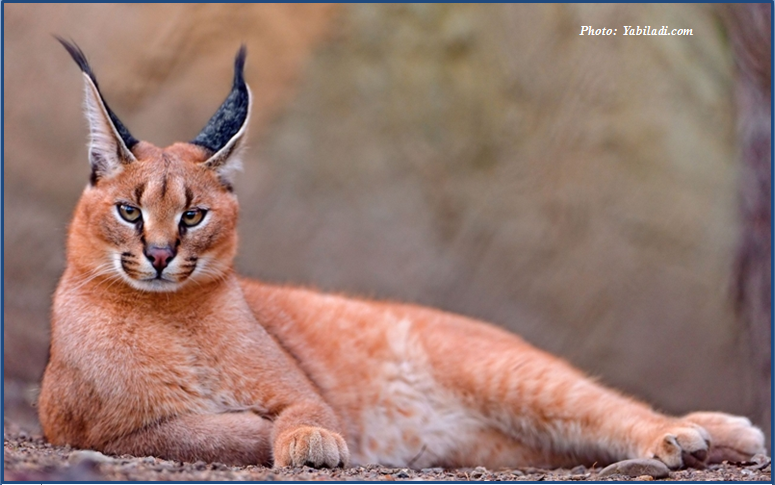
Mrirt: observation d’un caracal
Mrirt: observation d’un caracal Un ornithologue marocain a observé un caracal à l’état sauvage, la semaine dernière, dans la région de Mrirt. Encore une de ces nouvelles qu’on aime. L
Savoir plus...
Défense de l'Environnement- Partenaires - durabilité
La défense de l’environnement ne s’arrête pas à nos frontières Les problèmes environnementaux n’ont pas de frontières. La destruction de la biodiversité ou le changeme
Savoir plus...
NOTE SUR LES CHANGEMENTS CLIMATIQUES RÉGION DE GUELMIM OUED-NOUN POUR LE PORTAIL DU CENTRE DE COMPÉTENCE CHANGEMENT CLIMATIQUE DU MAROC (4C) (Géoparc Jbel Bani)
NOTE SUR LES CHANGEMENTS CLIMATIQUES RÉGION DE GUELMIM OUED-NOUN POUR LE PORTAIL DU CENTRE DE COMPÉTENCE CHANGEMENT CLIMATIQUE DU MAROC (4C) (Géoparc Jbel Bani) CARACTÉRISATION DE LA RÉGION La r&
Savoir plus...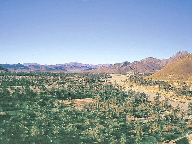
Naissance d’une association pour le développement du Géoparc de Jbel Bani à Tata (Géoparc Jbel Bani)
Naissance d’une association pour le développement du Géoparc de Jbel Bani à Tata (Géoparc Jbel Bani) La ville de Tata a abrité, le 10 avril courant, la 8ème édition de sa foire a
Savoir plus...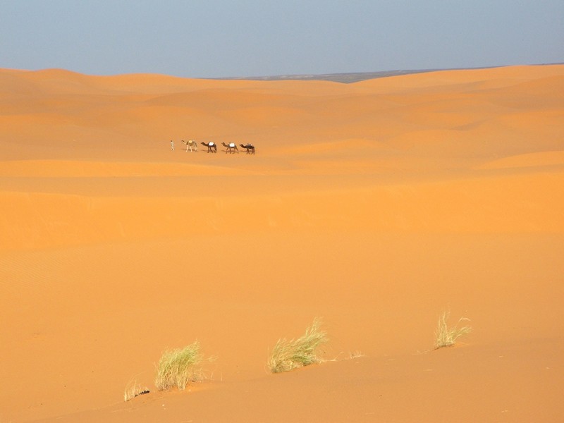
Le mystère des sons du désert résolu
Le mystère des sons du désert résolu Il est connu que les sons étranges entendus dans le désert sont produits par les dunes de sable sujettes aux avalanches. Mais le mécanisme exact qui se tr
Savoir plus...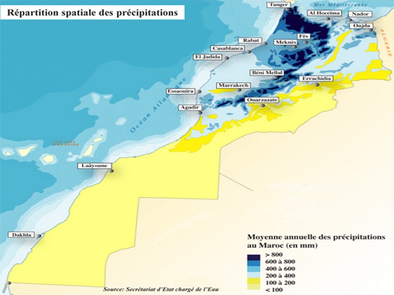
Retard des pluies: Faut-il craindre le pire?
Retard des pluies: Faut-il craindre le pire? Il est encore tôt pour prédire une année sèche Les mois de décembre et janvier seront de vrais baromètres Le régim
Savoir plus...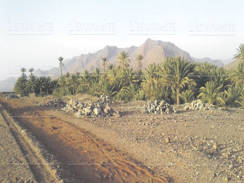
Le Géoparc Jbel Bani et Foum Zguid, à la porte du désert, la pastèque menace la nappe phréatique
Le Géoparc Jbel Bani et Foum Zguid, à la porte du désert, la pastèque menace la nappe phréatique A 170 km d’Ouarzazate, à Foum Zguid, c’est la porte du désert. Le tourisme
Savoir plus...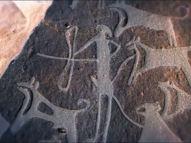
Des chiens en laisse à la Préhistoire !
Des chiens en laisse à la Préhistoire ! Dans les scènes de chasse de deux sites d'art rupestre d'Arabie saoudite datant du prénéolithique, des dizaines de chiens sont gravés en compag
Savoir plus...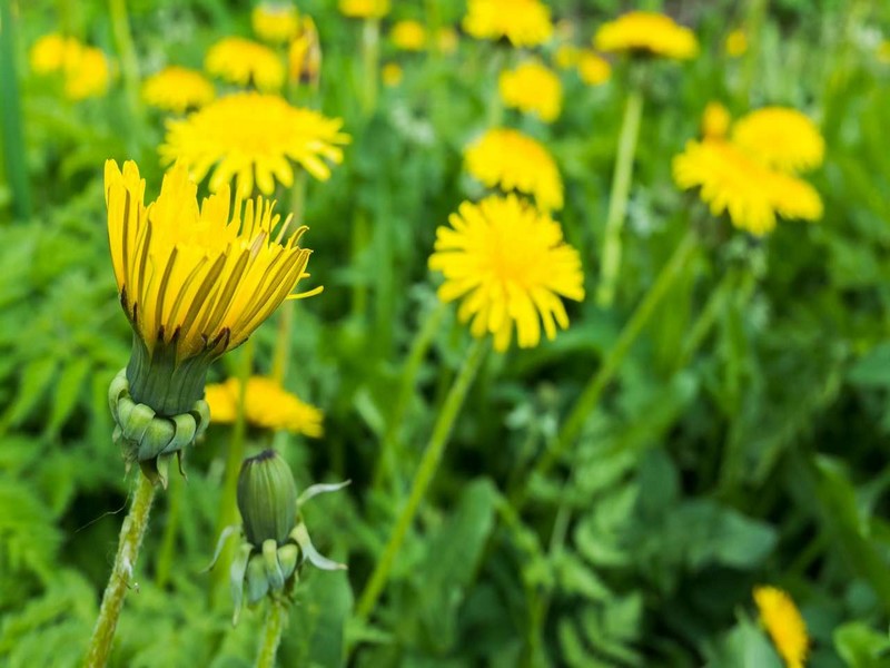
Ortie, pissenlit : les bienfaits des mauvaises herbes
Ortie, pissenlit : les bienfaits des mauvaises herbes Elles encombrent votre jardin, poussent dans la pelouse, entre les dalles de la terrasse ou contre les murs : ne jetez pas toutes les mauvaises herbes, certaines comme l
Savoir plus...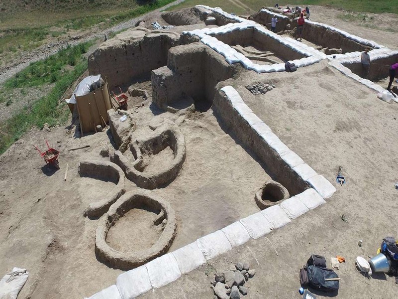
L'Homme ferait du vin depuis au moins 8.000 ans
L'Homme ferait du vin depuis au moins 8.000 ans Lors de fouilles effectuées en Géorgie, des poteries âgées d'environ 8.000 ans ont été retrouvées. Des traces chimiques montrent
Savoir plus...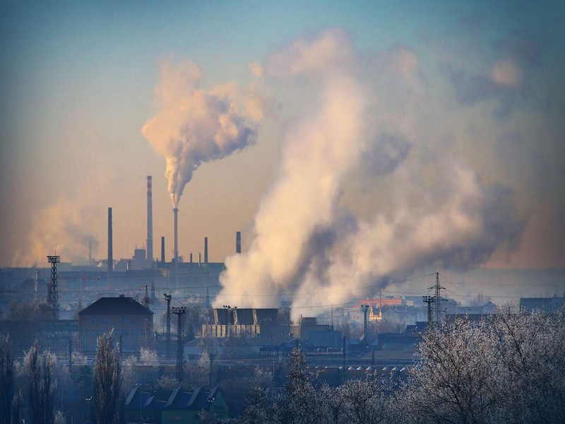
Gaz à effet de serre : CO2 ou méthane, quel est le pire ?
Gaz à effet de serre : CO2 ou méthane, quel est le pire ? Le dioxyde de carbone et le méthane sont parmi les gaz à effet de serre les plus connus. L'augmentation de leur émission dans l'atmo
Savoir plus...
L’espace culturel de la place Jemaa el-Fna
L’espace culturel de la place Jemaa el-Fna Inscrit en 2008 sur la Liste représentative du patrimoine culturel immatériel de l’humanité (originellement proclamé en 2001) Pays : Maroc Descr
Savoir plus...Les tags en relation
En savoir plus sur " Géologie et TSGJB - AMDGJB ! "
Consulter les vidéos de " Géologie et TSGJB - AMDGJB ! " Consulter les photos de " Géologie et TSGJB - AMDGJB ! " Consulter les publications de " Géologie et TSGJB - AMDGJB ! " Consulter les éditions de " Géologie et TSGJB - AMDGJB ! " Consulter les communications de " Géologie et TSGJB - AMDGJB ! "Recherche du site
Recherche avancée / SpécifiqueVulgarisation à la géologie
Qu'est ce que les sciences de la terre: vulgarisation Qu'est ce que la géologie ? Géologie et TSGJB - AMDGJB !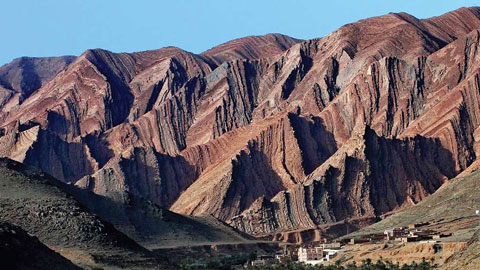
Géoparc et Recherche Scientifique
Le coins de l’étudiant
Blog Géoparc Jbel Bani
Dictionnaire scientifique
Plus de 123.000 mots scientifiques
Les publications
Géo parc Jbel Bani

Circuits & excursions touristiques
cartothéques
Photothéques
Publications & éditions