A plate tectonic evolution of the Anti-Atlas on a global scale
DR.Hervé Rezeau, DR.Cyril Chelle-Michou & DR.Michael Calder
SEG Student Chapter of Geneva (Switzerland)
SEG Student Chapter of Montpellier (France)
In the western Maghreb, the Variscan (Hercynian) belt extends into the Meseta and Atlas do- mains, being widely exposed in the large Paleozoic massifs of the Moroccan Western Meseta and West- ern High Atlas, whereas it forms smaller massifs in the Eastern Meseta, Middle Atlas and Central- Eastern High Atlas (Fig.1). Altogether, these massifs define the Meseta Domain, whose late Paleozoic evolution was accompanied by significant metamorphism and magmatic intrusions. This domain is also referred to as the Meseta Block (although it was not a single block until the end of the Variscan Orogeny) and corresponds to the southwesternmost segment of the Variscan belt of Europe. The Anti-Atlas belt extends south of the Meseta Domain and can be regarded as the common foreland fold belt of both the Mesetan Variscides and northernmost Mauritanides. The Anti-Atlas belt connects to the east with the coeval, intracontinental Ougarta belt that extends essentially into the Algerian territory (Fig.1).

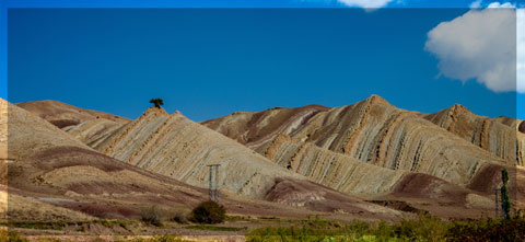
Figure 1: Landsat image of Morocco (from Michard et al. 2008)
The tectonic evolution of the Anti-Atlas basin and fold belt in relation to plate tectonics on aglobal scale is illustrated in Fig. 2, and summarized below (Burkhard et al., 2006):
(1)During the Panafrican orogeny, a series of terranes are accreted to the West African craton on its northern and probably western side. While the northeastern suture (Bou Azzer) and terranes to the northeast will remain in place, northwestern and western borders are subsequently reactivated and a series of terranes or continental fragments will be ripped off again during the Palaeozoic. The southwestern Anti-Atlas, however, at the margin of the Saharan metacraton remains attached to Gondwana throughout its Palaeozoic history.
(2)In Late Proterozoic–Early Cambrian, the Anti-Atlas area is in extension with the formation of many widely distributed graben and halfgraben structures, filled in with coarse clasts mostly of igneous origin. The youngest volcanism is tholeiitic–alkaline and indicates an intracontinental setting. The geodynamic significance of this extensional event is not entirely clear, however. It could be related to a southeast dipping, major and longlived subduction zone on the northwestern margin of Gondwana, causing a wide area of extension cratonward in a basin and range style.
(3)From Middle Cambrian through Middle Carboniferous, the western Anti-Atlas basin is characterized by a strong and essentially linear subsidence trend, leading to the accumulation of more than 10 km of mostly fine-grained clastic sediments, shed into an epicontinental sea from the African craton. There is little evidence in this stratigraphic record for tectonic events postulated to have taken place along the active northwestern plate margin of Gondwana. The departure of Avalon, Armorica and Hunic terranes from this margin in successive events of back-arc spreading must have brought the Anti-Atlas Sea increasingly closer to the open ocean(s) (Rheic and Palaeo-Tethys). From Silurian times onward, the Anti-Atlas Basin could thus represent the passive margin of the Palaeo-Tethys ocean, but very little if any sediments of the more distal parts of this passive margin are preserved anywhere (with the possible exception of terrains west of Guelmin and near Tineghir).
(4)In Late Carboniferous–Permian (?) compression leads to an event of strong inversion and folding. Basement is uplifted and folded into huge antiformal culminations (boutonnières) which punctuate the southwestern Anti-Atlas fold belt. The structural relief of the basement culminations is in excess of 10 km; minimum estimates of total shortening are 15 to 25 km. The Anti-Atlas belt does not represent a classical frontal, thin-skinned foreland fold-and-thrust-belt of the Appalachian–Variscan orogen, however, but rather an intracratonic, thick-skinned basement inversion belt. Similar time-equivalent belts occur further east into the African craton (Ougarta, Ahnet), but no such structures are known on the American side of the Appalachian chain.

Figure. 2: Evolution of the Variscan segments of Morocco during the Paleozoic, after Burkhard et al. (2006), based on the paleogeographic maps of Stampfli & Borel (2002). The figure is modified according to G. Stampfli, personal comm., in litt. 2008. The Meseta block is considered as separated from Gondwana (Anti-Atlas) by a Devonian Ocean (“Paleo-Tethys”). Aval, Av: Avalonian terranes; Meg: Meguma; WA/NAC: West African/North American Craton. From Michard et al. (2008).
Source web: DR.Hervé Rezeau, DR.Cyril Chelle-Michou & DR.Michael Calder unige.ch
Les articles en relation
Le Système solaire au cœur d'un ouragan de matière noire ? Ah bon ?
Le Système solaire au cœur d'un ouragan de matière noire ? Ah bon ? Les raisons de croire à l’existence de la matière noire sont plus solides que jamais. Mais ce n’est pas une raison
Savoir plus...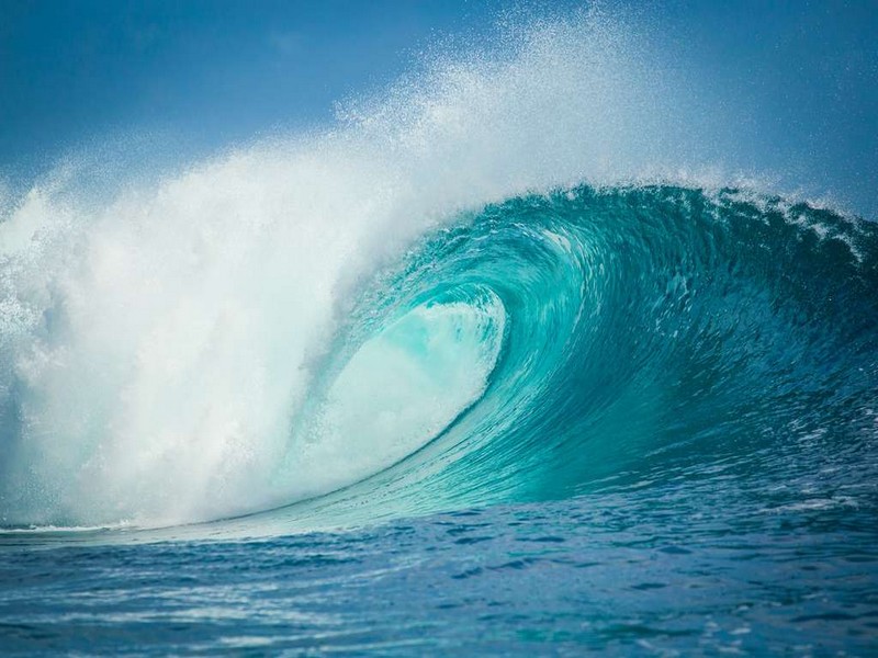
Vague
Vague Du point de vue du physicien, une vague correspond à une onde mécanique qui se propage à l'interface entre la surface de l'eau et l'air. Celle-ci se caractérise par sa longueur d'onde
Savoir plus...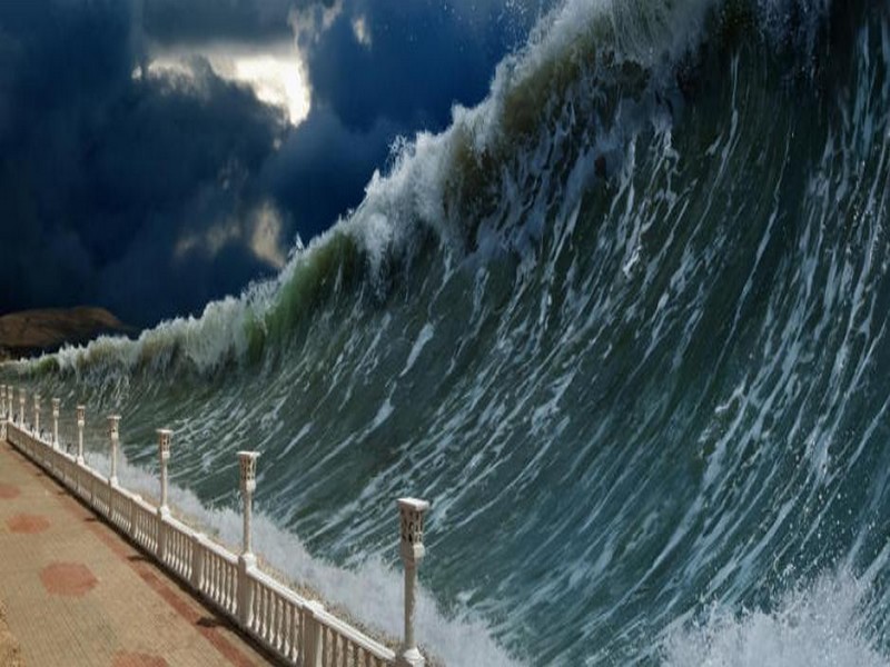
Ce risque de tsunami dévastateur en Méditerranée
Ce risque de tsunami dévastateur en Méditerranée Les côtes méditerranéennes pourraient-elle être balayées par un tsunami ? D'après certains chercheurs, le danger est bi
Savoir plus...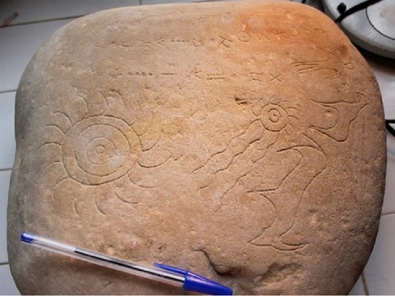
Astroarchéologie: Ce chercheur explique pourquoi cette découverte au Maroc est exceptionnelle
Astroarchéologie: Ce chercheur explique pourquoi cette découverte au Maroc est exceptionnelle MÉTÉORITES - Des chercheurs marocains ont récemment fait une découverte de taille pour l’as
Savoir plus...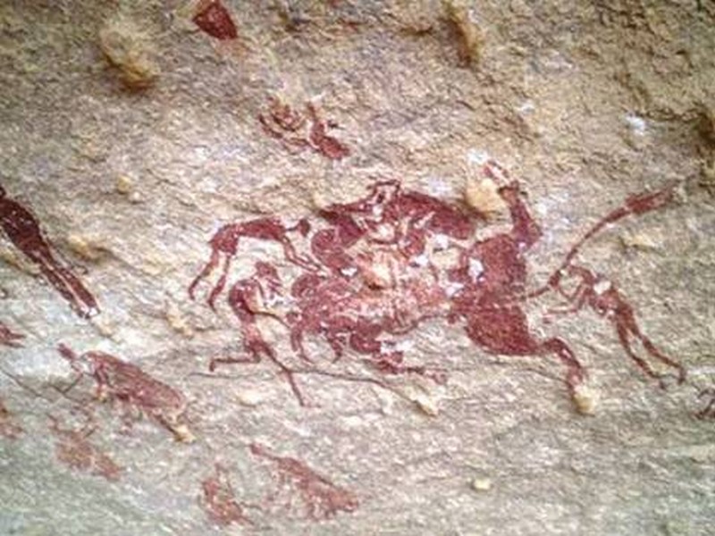
Appel à la protection des gravures rupestres de Nâama
Appel à la protection des gravures rupestres de Nâama Découverte en 1847 par une expédition française, la station de Tiout, dans le Sud de la wilaya de Naâma, date de plus de 8 000 ans avant J.
Savoir plus...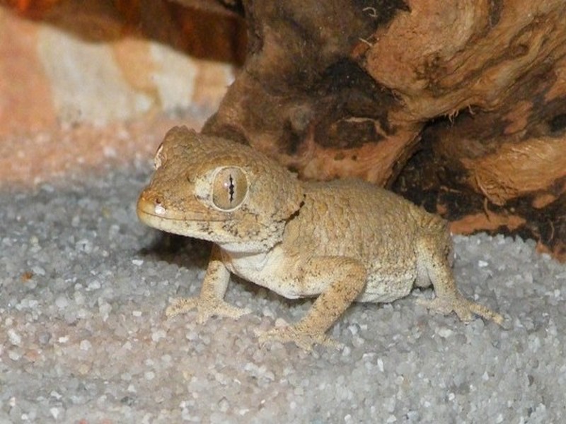
Le gecko casqué
Le gecko casqué Le gecko casqué (Tarentola chazaliae) est un lézard de petite taille qui ne dépasse pas 10 cm de longueur. Il doit son nom à la forme de sa tête qui rappelle celle d’un c
Savoir plus...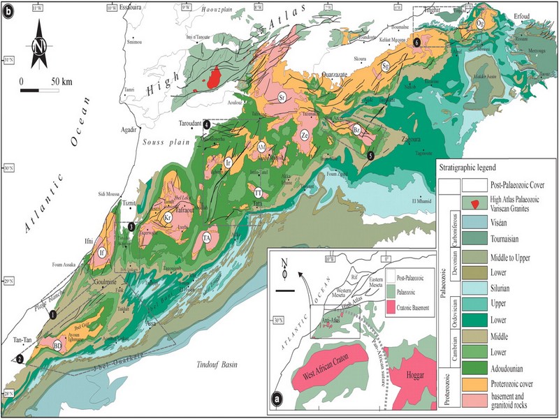
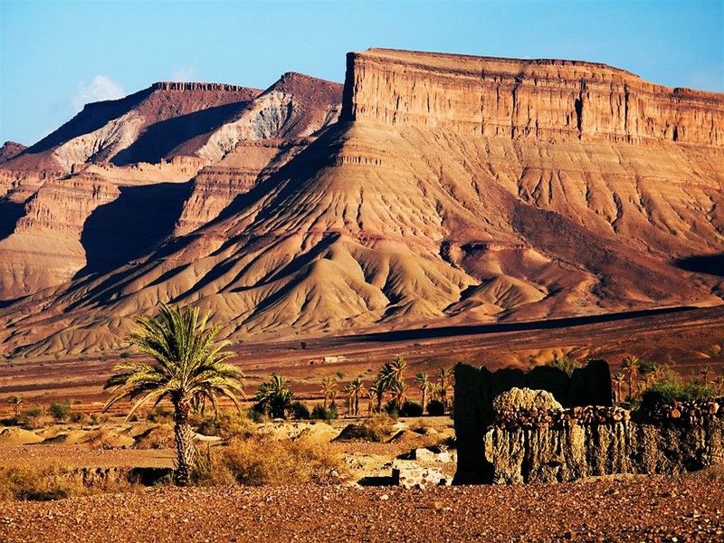
A short overview of the Anti-Atlas, Morocco
A short overview of the Anti-Atlas, Morocco DR.Hervé Rezeau, DR.Cyril Chelle-Michou & DR.Michael Calder SEG Student Chapter of Geneva (Switzerland) &nb
Savoir plus...
Les épinards rendent-ils vraiment plus costaud ?
Les épinards rendent-ils vraiment plus costaud ? « Mange tes épinards, si tu veux devenir fort ! » Enfant, nous avons tous entendu cette recommandation. Mais notre maman savait-elle r&ea
Savoir plus...
L’arbre sacré des régions du Sud: Les gardiennes de l’arganier
L’arbre sacré des régions du Sud: Les gardiennes de l’arganier L’Union des coopératives des femmes d’argane s’est distinguée à la COP22 en remportant le prix de l&rsquo
Savoir plus...
Des continents perdus découverts sous la glace en Antarctique
Des continents perdus découverts sous la glace en Antarctique Les mesures fines du champ de gravité de la Terre par le satellite de l'ESA Goce ont permis de voir sous la glace de l'Antarctique. Les géophy
Savoir plus...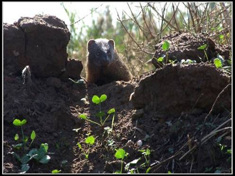
La Mangouste Ichneumon
La Mangouste Ichneumon Vivant dans nombreuses régions du pourtour saharien et d’Afrique, la mangouste Ichneumon (herpestes ichneumon) est la plus grand mangouste d’Afrique. Au Maroc, on trouve cet animal dans le d&
Savoir plus...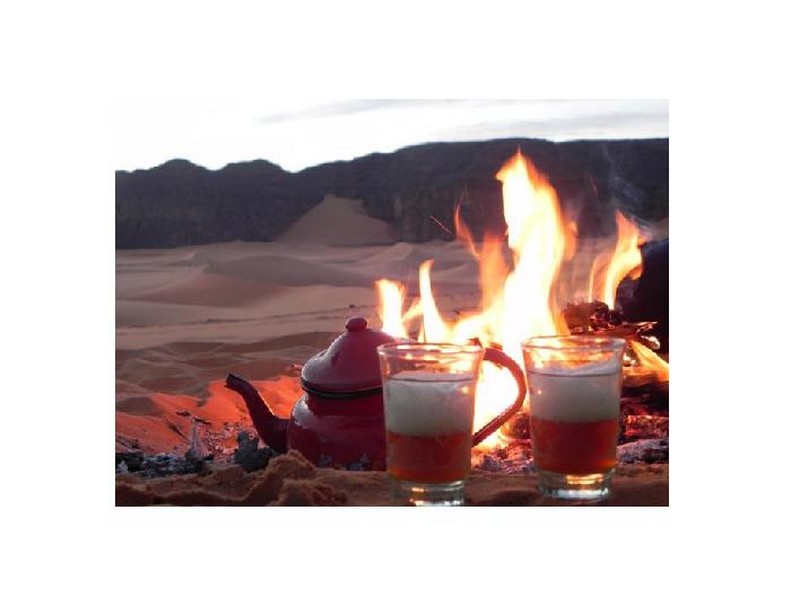
La Sabulum thérapie, les bienfaits du bain de sable
La Sabulum thérapie, les bienfaits du bain de sable Tous les étés entre les mois de mai et septembre, alors que le tourisme du désert est au point mort, les professionnels de l’hébergement de
Savoir plus...Les tags en relation
En savoir plus sur " Géologie et TSGJB - AMDGJB "
Consulter les vidéos de " Géologie et TSGJB - AMDGJB " Consulter les photos de " Géologie et TSGJB - AMDGJB " Consulter les publications de " Géologie et TSGJB - AMDGJB " Consulter les éditions de " Géologie et TSGJB - AMDGJB " Consulter les communications de " Géologie et TSGJB - AMDGJB "Recherche du site
Recherche avancée / Spécifique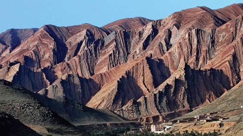
Géoparc et Recherche Scientifique
Le coins de l’étudiant
Blog Géoparc Jbel Bani
Dictionnaire scientifique
Plus de 123.000 mots scientifiques
Les publications
Géo parc Jbel Bani

Circuits & excursions touristiques
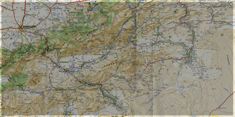
cartothéques
Photothéques
Publications & éditions