
STRUCTURAL EVOLUTION OF THE ANTI-ATLAS DOMAIN :AN OVERVIEW pour Yves Missenard
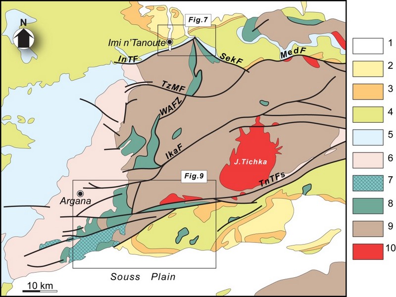
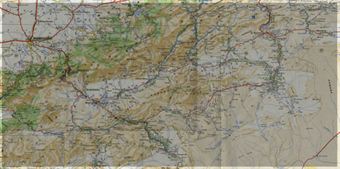
The Anti-Atlas represents the most important segments of the major Pan-African (≈0.5Ga) belt system of North Africa. This orogen exposed in a series of sporadic SW–NEtrending outcrops over 700km across southern Morocco, and reach ≈150km wide in the central part, west of Ouarzazate (Figure G1 & G2).Scattered outcrops of related rocks are described in NW Algeria which indicate that the belt continues from SE Morocco southeastwards with a NW–SEtrend.
The Anti-Atlas orogen comprises two main sequences of rocks: a metamorphic basement of Palaeoproterozoic (2Ga) age and the Neoproterozoic rocks. The Palaeoproterozoic rocks form the northern margin of the West African Craton mainly outcropping in the Reguibate Shield in Mauritania And Algeria. The Palaeoproterozoic basement is exposed in a series of uplifted inliers (‘‘boutonnieres’’) surrounded by the Neoproterozoic rocks that were locally deformed with the basement during the Pan African Orogeny. with the during the Pan African Orogeny.
Paleoproterozoic rocks and Eburnian orogeny
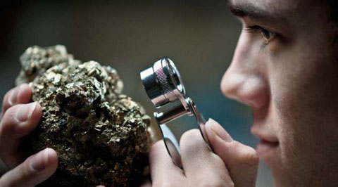
The oldest rocks of Morocco, Archean in age3 Ga(Montero et al, 2014) crop out in the southernmost Reguibat E shield which formsthe northern part the West African Craton (WAC).Further north, in the Anti-Atlas chain, the basement units are Paleoproterozoic (Taznakht Group, former” PI”)cropping only in the south of the Anti-Atlas Major Fault (AAMF). They are metamorphic rocks (greenschist to amphibolite facies) intruded by peraluminous and calc-alkaline granitoids dated around 2Ga(Thomas et al, 2002).The corresponding tectono-magmatic and metamorphic events are assigned to the Eburnian/Birimian orogeny.
Neoproterozoic rocks and Pan-African orogeny
As everywhere in the WAC, Mesoproterozoic rocks are lacking in the Anti-Atlas. Neoproterozoic Formations overlie directly the Paleoproterozoic basement. The Neoproterozoic/Paleoproterozoic boundary is generallya tectonic contact (thrust, strike-slip or detachment faults), and seldom a stratigraphic contact (Tizi n’Taghatine). Globally, the Neoproterozoic formations record three main stages of the Pan-African cycle (figureG4):
I .The early Neoproterozoic platform development is marked by the accumulation of thousands of meters of quartzites and stromatolitic limestones (Taghdoute Group, former “PII”), intruded by doleritic dykes and gabbroic intrusions. These rocks are associated with the rifting of the WAC margin, broadly contemporaneous with the oceanic accretion further north (760 Ma), witnessed along the AAMF by the Bou Azzer-El Graara and Siroua ophiolitic sequences (Bou Azzer Group).
II .Oceanic closure and subsequent Pan-African collision are associated with oceanic subduction along the northern margin of the WAC, ending with the accretion of oceanic arc formations (figureG4).The reported “blueschist facies” mineral associations in the Bou Azzer inlier are controversial. The polarity of the subduction remains also matter of debates; the same is true for the real location of the northern edge of the WAC. The oblique Pan-African collision(655 Ma to 640 Ma) generated south-verging thrust sheets onto the cratonic margin. South of the AAMF, the main Pan-African phase is recorded by low grade recrystallizations, synmetamorphic folds and various ductile and brittle structures in the Taghdout Group series.
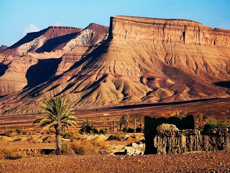
III The Late to Post Pan-African extensional event is recorded by the extensive volcanic and volcano clastic series of the Ouarzazate Group (former “PIII”, 580 Ma to 560Ma), interbedded with subaerial to lacustrine deposits, which unconformably overlie the Eburnian and/or Pan-African basement units. The Ouarzazate Group shows abrupt variations of thickness and facies controlled by extensional tectonic activity. Various high-K calc-alkaline to alkaline plutons emplaced within the Ouarzazate Group, coeval with the volcanic rocks of comparable chemistry.

FigureG4: Generalized lithostratigraphic column for the Anti-Atlas Pan-African orogen. “PI” = “XI”, etc. are the classical stratigraphic symbols used on Anti-Atlas geological maps. HKCA: High-K calc-alkaline (granitoids) after Thomas et al. (2004), Gasquet et al. (2005) and Liégeois et al.2006 in Youbi et al., 2013

Source web par sociedadgeologica.es
Les articles en relation
Rififi autour du géopark de Jbel Bani
Rififi autour du géopark de Jbel Bani Alors que le Conseil provincial de Tata a procédé à la création de la Fondation provinciale du Bani Geopark, lors de sa dernière session, l’associa
Savoir plus...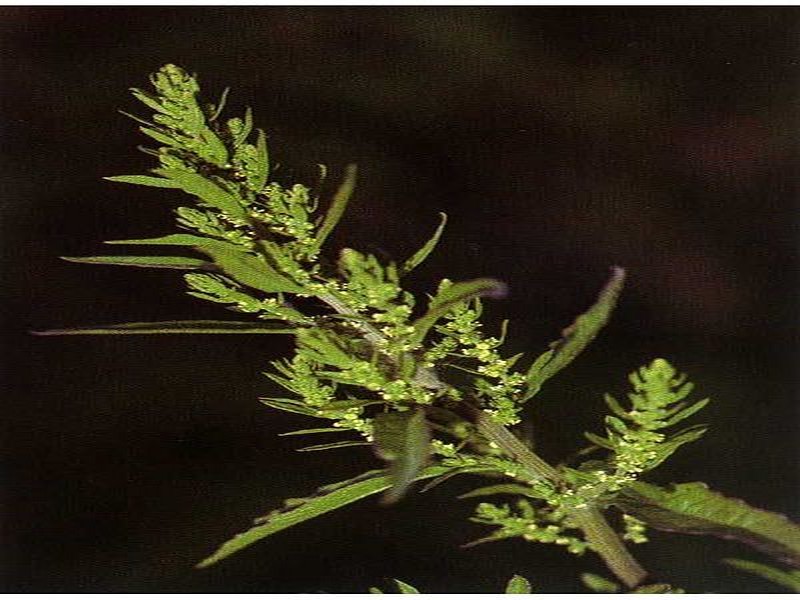
M’khinza, une plante toxique?
M’khinza, une plante toxique? Le Centre antipoison et de pharmacovigilance du Maroc (CAPM) met en garde les citoyens contre l’utilisation de M’khinza ou ansérine vermifuge. Le centre avait émis une ale
Savoir plus...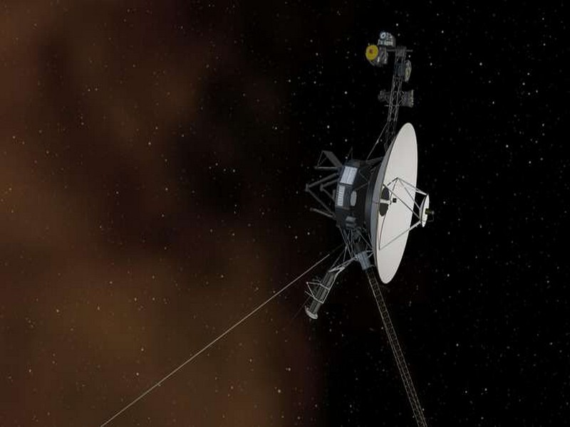
Voyager 2 serait proche de la frontière avec l'espace interstellaire
Voyager 2 serait proche de la frontière avec l'espace interstellaire Partie de la Terre, il y a déjà 41 ans, la sonde Voyager 2 pourrait bientôt entrer dans l'espace interstellaire. Il y a six ans,
Savoir plus...
Réchauffement climatique : les prévisions du Giec étaient trop optimistes
Réchauffement climatique : les prévisions du Giec étaient trop optimistes D'ici 2100, la Terre pourrait se réchauffer de 15 % de plus que la pire des prédictions du Giec (Groupe d'experts in
Savoir plus...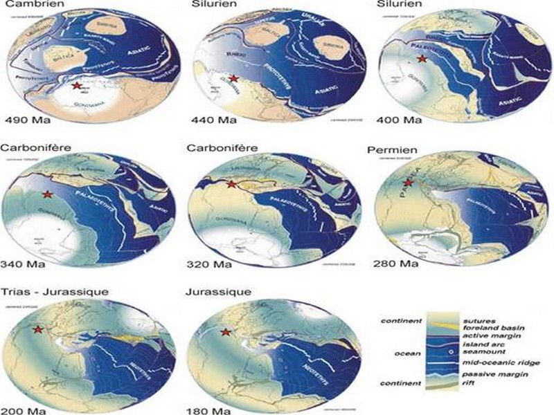
CADRE GEOLOGIQUE pour Charles Robert-Charrue
CADRE GEOLOGIQUE pour Charles Robert-Charrue Etat des connaissances Tectonique globale L’Anti-Atlas est situé sur la bordure nord du craton ouest africain (Figure 2, p. 3). Cette zone est particulière
Savoir plus...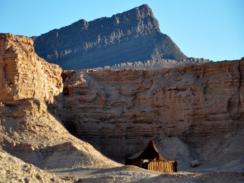
LES EMBOUCHURES DES OUEDS
LES EMBOUCHURES DES OUEDS Foum Assaka, site d’intérêt touristique qui attire déjà les professionnels du tourisme. Cette côte d’une grande richesse paysagère et écologique fai
Savoir plus...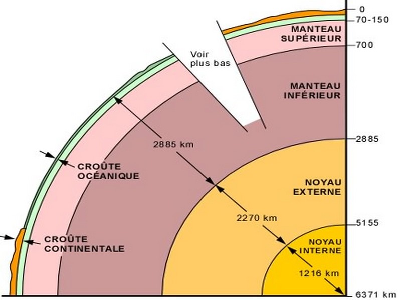
La structure interne de la Terre
L'intérieur de la Terre est constitué d'une succession de couches de propriétés physiques différentes: au centre, le noyau, qui forme 17% du volume terrestre et qui se divise en noyau interne s
Savoir plus...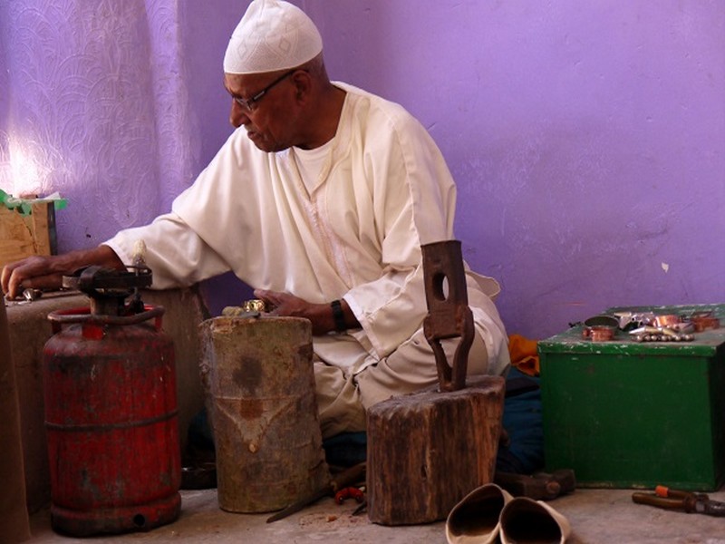
Artisanat : Les artisans marocains
Indifférents au temps qui passe, les artisans du sud Maroc ont de tout temps joué un rôle prépondérant dans le quotidien des populations berbères. Au départ essentiellement domestique,
Savoir plus...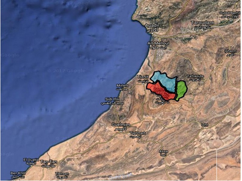
La Tribu Ida Oultite
La Tribu Ida Oultite Histoire d'Ida Oultite Ida Oultite est composée de trois tribus berbère du même origine: 1. Ida Garsmouk 2. Ida Baakil
Savoir plus...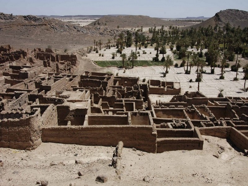
Oasis et anti atlas –tata
Tata est une oasis du sud marocain, elle se situe à proximité de la frontière Algérienne sur les contreforts de l’Anti-Atlas. La petite ville de Tata se trouve à 289 km au sud de la ville d&rsqu
Savoir plus...
Découvertes des vertébrés continentaux du Crétacé d’Afrique du Nord : historique
Découvertes des vertébrés continentaux du Crétacé d’Afrique du Nord : historique Découvertes des vertébrés continentaux du Crétacé d’Afrique du Nord :
Savoir plus...Les tags en relation
En savoir plus sur " Géologie et TSGJB - AMDGJB ! "
Consulter les vidéos de " Géologie et TSGJB - AMDGJB ! " Consulter les photos de " Géologie et TSGJB - AMDGJB ! " Consulter les publications de " Géologie et TSGJB - AMDGJB ! " Consulter les éditions de " Géologie et TSGJB - AMDGJB ! " Consulter les communications de " Géologie et TSGJB - AMDGJB ! "Recherche du site
Recherche avancée / SpécifiqueVulgarisation à la géologie
Qu'est ce que les sciences de la terre: vulgarisation Qu'est ce que la géologie ? Géologie et TSGJB - AMDGJB !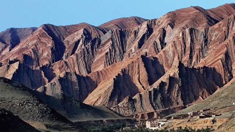
Géoparc et Recherche Scientifique
Le coins de l’étudiant
Blog Géoparc Jbel Bani
Dictionnaire scientifique
Plus de 123.000 mots scientifiques
Les publications
Géo parc Jbel Bani

Circuits & excursions touristiques
cartothéques
Photothéques
Publications & éditions