A short overview of the Anti-Atlas, Morocco
DR.Hervé Rezeau, DR.Cyril Chelle-Michou & DR.Michael Calder
SEG Student Chapter of Geneva (Switzerland)
SEG Student Chapter of Montpellier (France)
INTRODUCTION
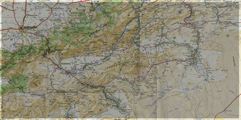
Geology of Morocco has been subdivided into four structural domains, from north to south they are the following: the Rif domain, the Meseta domain, the High Atlas, and the Anti-Atlas, as they are shown in (Figure 1).
The Rif Range extends along the Mediterranean coast from the Kabylian-Tellian belts up to the Strait of Gibraltar. South of it, the Meseta domain is located, where elevated plateaus and intramontane basins occur. Further south the High Atlas system is found, which displays several massifs close to 4000 m, including the highest peak of northern Africa (Jebel Toubkal). The Middle Atlas represents a branch of the Atlas system that extends obliquely across the Meseta domain, and exceeds 3000 m in elevation. Finally, the Anti-Atlas domain is found, which rises forming a massive mountain that achieves up to 2700 m. Further south the elevation decreases both southward and westward from ca. 1000 m to less than 200 m close to the Atlantic.

Figure 1: Elevation map of Morocco and neighbouring countries from GTOPO30 database (A. Michard et al. 2008)
GEOLOGICAL SETTING OF THE ANTI-ATLAS
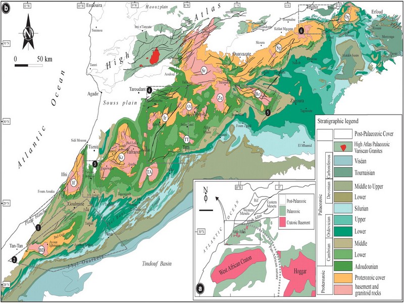
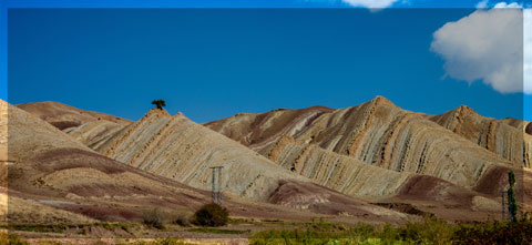
The Anti-Atlas mountain belt is located in the northern part of the West African Craton (WAC). It is stretching NE-SW and is characterized by Precambrian to late Proterozoic rocks covered by younger sediments of Edicaran to Cambrian in age. The geological boundary between the Anti-Atlas and High Atlas is structurally marked by the South Atlas fault (SAF) (Fig.2). The Anti-Atlas massif is a zone of wide domal uplift with much weaker Alpine age deformation. The volcanics and conglomerates rocks from the Ouarzazate & Bou Salda group in the North-East are surrounding the older volcanics rocks
The Anti-Atlas mountain belt is located in the northern part of the West African Craton (WAC). It is stretching NE-SW and is characterized by Precambrian to late Proterozoic rocks covered by younger sediments of Edicaran to Cambrian in age. The geological boundary between the Anti-Atlas and High Atlas is structurally marked by the South Atlas fault (SAF) (Fig.2). The Anti-Atlas massif is a zone of wide domal uplift with much weaker Alpine age deformation. The volcanics and conglomerates rocks from the Ouarzazate & Bou Salda group in the North-East are surrounding the older volcanics rocks and turbidite sequences from the Sahgro Group and the Pan-African granite intrusions. This geomorphological feature is commonly called inliers (“boutonnière” in French) and is the result of an exposed older rock formation surrounded by younger rock, and is due to a high erosion rate of rocks with different hardness but also encouraged by deformation such as folding and faulting (Gasquet et al. 2005). Several slivers of ophiolites are present in the Anti-Atlas belt, the best preserved are situated in the Bou Azzer, Siroua and Iriri region, which represent remnant of an ocean closure. The basement is composed of schists, granites and mylonites of Paleoproterozoic age. The latest Variscan and Alpine orogenic events overprint most of the Anti-Atlas geological province and thus complicate the Pre- Cambrian geodynamic interpretation. However, two main periods of tectono-thermal magmatic activity (Gasquet et al. 2005) are now recognised :
(i)A Palaeoproterozoic period, corresponding to the Eburnean (Birimian) orogeny,
(ii)A Neoproterozoic period, corresponding to the Pan-African orogeny.

Figure 2: Schematic map of the Anti-Atlas Precambrian inliers (Boutonnière), and location of the maps, satellite views and lithospheric profile presented hereafter (Gasquet et al. 2008)
Source web : DR.Hervé Rezeau, DR.Cyril Chelle-Michou & DR.Michael Calder unige.ch
Les articles en relation
Empreintes de dinosaures : la plus longue piste de sauropode est en France!
Empreintes de dinosaures : la plus longue piste de sauropode est en France! En 2009, la découverte d'empreintes d'un dinosaure gigantesque, à Plagne, dans le massif du Jura, avait été annoncé
Savoir plus...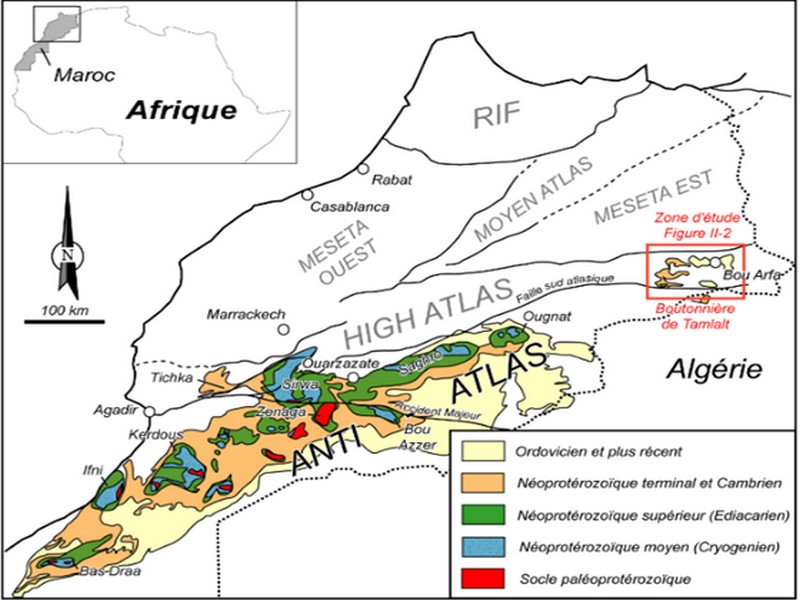
L’Anti-Atlas marocain
L’Anti-Atlas marocain L’Anti-Atlas marocain constitue le domaine structural majeur du Sud du Maroc (Figure I-3). Il s’agit d&rs
Savoir plus...
L'énergie éolienne menacée par le réchauffement climatique ?
L'énergie éolienne menacée par le réchauffement climatique ? Une étude, à prendre avec des pincettes car c'est la première du genre, prédit que les vents souffleront moi
Savoir plus...
L'Homme ferait du vin depuis au moins 8.000 ans
L'Homme ferait du vin depuis au moins 8.000 ans Lors de fouilles effectuées en Géorgie, des poteries âgées d'environ 8.000 ans ont été retrouvées. Des traces chimiques montrent
Savoir plus...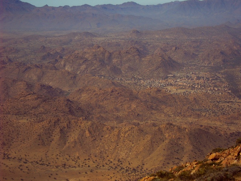
Fiche technique du SIBE "Jbel Kest (62)" (Géoparc Jbel Bani)
Fiche technique du SIBE "Jbel Kest (62)" (Géoparc Jbel Bani) Date de publication 27/11/2006 Couverture géographique Maroc, Mots-clefs Aire protégée, SIBE, Coordonnées : 29°
Savoir plus...
Disparition des dinosaures : l'astéroïde aurait plongé la Terre dans la nuit durant 2 ans
Disparition des dinosaures : l'astéroïde aurait plongé la Terre dans la nuit durant 2 ans Une nouvelle simulation de l'impact des incendies producteurs de suies causés par l'impact d'un ast&e
Savoir plus...
Le Loup de Guelmim (Observation filmée)
Le Loup de Guelmim (Observation filmée) Le Loup de Guelmim. C’est la première observation qui nous est rapporté en ce début 2016. « Quelques parts » dans la région de Guelmim, A
Savoir plus...
Découverte. Sur les traces des dinosaures d’Anza Beach, près d'Agadir
Des empreintes de dinosaures carnivores et de reptiles volants, vieux de 85 millions d'années, ont été retrouvés sur la plage d'Anza près d'Agadir. Les détails. C’est offici
Savoir plus...
ONU: 2017, dans le Top 3 des années les plus chaudes de l'histoire
ONU: 2017, dans le Top 3 des années les plus chaudes de l'histoire L’OMM, l’Organisation météorologique mondiale révèle ce lundi 6 novembre que "marquée par des ph&eacut
Savoir plus...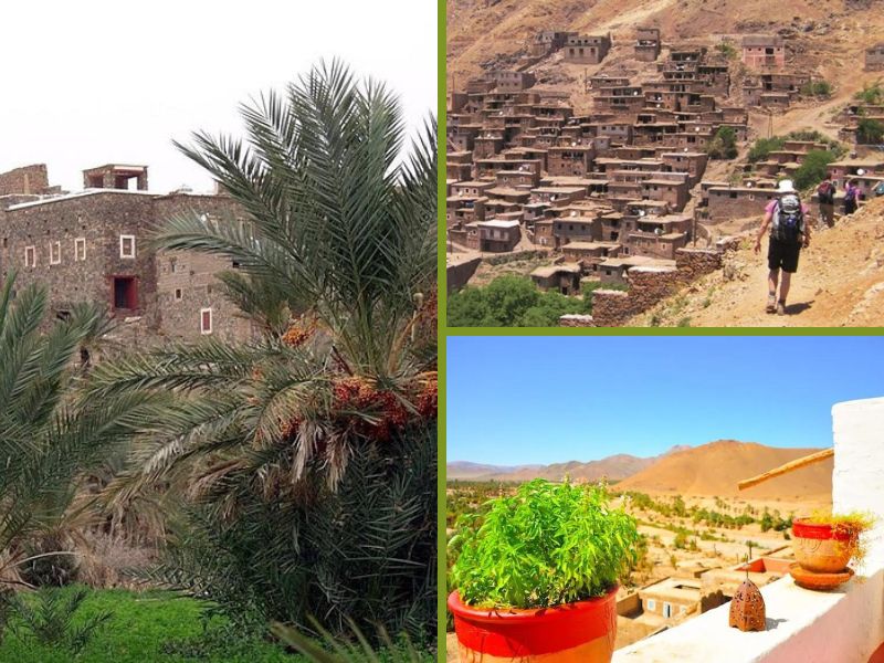
Favoriser le Tourisme Rural au Maroc dans un Contexte de Développement Local
Favoriser le Tourisme Rural au Maroc dans un Contexte de Développement Local Le Maroc, avec ses paysages diversifiés, sa culture riche et ses traditions authentiques, possède un fort potentiel pour le déve
Savoir plus...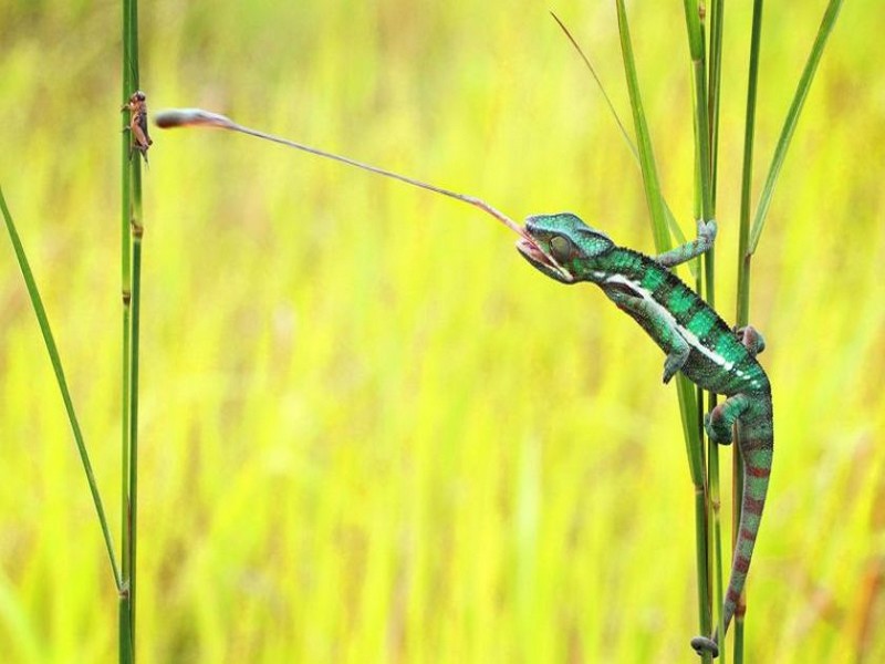
Le caméléon commun
Le caméléon est un reptile diurne et arboricole, il ne descend que rarement à terre. Il vit en solitaire et se montre très territorial sauf au moment de la reproduction. Les caméléons sont le
Savoir plus...Les tags en relation
En savoir plus sur " Géologie et TSGJB - AMDGJB "
Consulter les vidéos de " Géologie et TSGJB - AMDGJB " Consulter les photos de " Géologie et TSGJB - AMDGJB " Consulter les publications de " Géologie et TSGJB - AMDGJB " Consulter les éditions de " Géologie et TSGJB - AMDGJB " Consulter les communications de " Géologie et TSGJB - AMDGJB "Recherche du site
Recherche avancée / Spécifique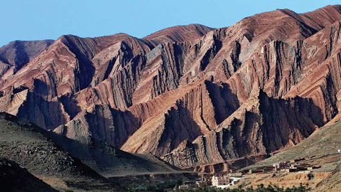
Géoparc et Recherche Scientifique
Le coins de l’étudiant

Blog Géoparc Jbel Bani
Dictionnaire scientifique
Plus de 123.000 mots scientifiques
Les publications
Géo parc Jbel Bani

Circuits & excursions touristiques
cartothéques
Photothéques
Publications & éditions