A short overview of the Anti-Atlas, Morocco
DR.Hervé Rezeau, DR.Cyril Chelle-Michou & DR.Michael Calder
SEG Student Chapter of Geneva (Switzerland)
SEG Student Chapter of Montpellier (France)
INTRODUCTION
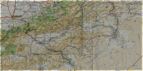
Geology of Morocco has been subdivided into four structural domains, from north to south they are the following: the Rif domain, the Meseta domain, the High Atlas, and the Anti-Atlas, as they are shown in (Figure 1).
The Rif Range extends along the Mediterranean coast from the Kabylian-Tellian belts up to the Strait of Gibraltar. South of it, the Meseta domain is located, where elevated plateaus and intramontane basins occur. Further south the High Atlas system is found, which displays several massifs close to 4000 m, including the highest peak of northern Africa (Jebel Toubkal). The Middle Atlas represents a branch of the Atlas system that extends obliquely across the Meseta domain, and exceeds 3000 m in elevation. Finally, the Anti-Atlas domain is found, which rises forming a massive mountain that achieves up to 2700 m. Further south the elevation decreases both southward and westward from ca. 1000 m to less than 200 m close to the Atlantic.

Figure 1: Elevation map of Morocco and neighbouring countries from GTOPO30 database (A. Michard et al. 2008)
GEOLOGICAL SETTING OF THE ANTI-ATLAS
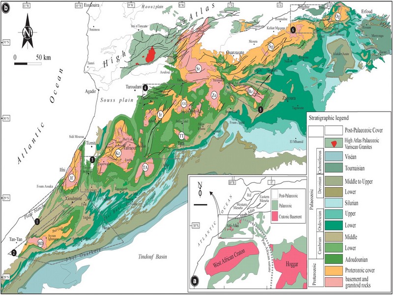
The Anti-Atlas mountain belt is located in the northern part of the West African Craton (WAC). It is stretching NE-SW and is characterized by Precambrian to late Proterozoic rocks covered by younger sediments of Edicaran to Cambrian in age. The geological boundary between the Anti-Atlas and High Atlas is structurally marked by the South Atlas fault (SAF) (Fig.2). The Anti-Atlas massif is a zone of wide domal uplift with much weaker Alpine age deformation. The volcanics and conglomerates rocks from the Ouarzazate & Bou Salda group in the North-East are surrounding the older volcanics rocks
The Anti-Atlas mountain belt is located in the northern part of the West African Craton (WAC). It is stretching NE-SW and is characterized by Precambrian to late Proterozoic rocks covered by younger sediments of Edicaran to Cambrian in age. The geological boundary between the Anti-Atlas and High Atlas is structurally marked by the South Atlas fault (SAF) (Fig.2). The Anti-Atlas massif is a zone of wide domal uplift with much weaker Alpine age deformation. The volcanics and conglomerates rocks from the Ouarzazate & Bou Salda group in the North-East are surrounding the older volcanics rocks and turbidite sequences from the Sahgro Group and the Pan-African granite intrusions. This geomorphological feature is commonly called inliers (“boutonnière” in French) and is the result of an exposed older rock formation surrounded by younger rock, and is due to a high erosion rate of rocks with different hardness but also encouraged by deformation such as folding and faulting (Gasquet et al. 2005). Several slivers of ophiolites are present in the Anti-Atlas belt, the best preserved are situated in the Bou Azzer, Siroua and Iriri region, which represent remnant of an ocean closure. The basement is composed of schists, granites and mylonites of Paleoproterozoic age. The latest Variscan and Alpine orogenic events overprint most of the Anti-Atlas geological province and thus complicate the Pre- Cambrian geodynamic interpretation. However, two main periods of tectono-thermal magmatic activity (Gasquet et al. 2005) are now recognised :
(i)A Palaeoproterozoic period, corresponding to the Eburnean (Birimian) orogeny,
(ii)A Neoproterozoic period, corresponding to the Pan-African orogeny.

Figure 2: Schematic map of the Anti-Atlas Precambrian inliers (Boutonnière), and location of the maps, satellite views and lithospheric profile presented hereafter (Gasquet et al. 2008)
Source web : DR.Hervé Rezeau, DR.Cyril Chelle-Michou & DR.Michael Calder unige.ch
Les articles en relation
Liste et photos des oiseaux du Maroc
« Le Maroc est certainement l’un des pays les plus riche en oiseaux du domaine paléarctique occidental (Europe, Afrique du Nord et Moyen-Orient) » Jaques Franchimont (GOMAC) 480 espèces ré
Savoir plus...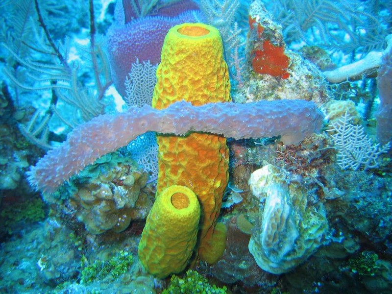
Les premiers animaux étaient peut-être des éponges
Les premiers animaux étaient peut-être des éponges Reconstituer l'origine des animaux, et en particulier sous formes multicellulaires, est l'une des clés permettant de déterminer notre origin
Savoir plus...
Les épinards rendent-ils vraiment plus costaud ?
Les épinards rendent-ils vraiment plus costaud ? « Mange tes épinards, si tu veux devenir fort ! » Enfant, nous avons tous entendu cette recommandation. Mais notre maman savait-elle r&ea
Savoir plus...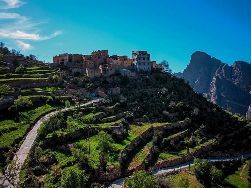
Les terrasses agricoles : un élément caractéristique du paysage de l’Anti-Atlas au Maroc (Géoparc Jbel Bani)
Les terrasses agricoles : un élément caractéristique du paysage de l’Anti-Atlas au Maroc (Géoparc Jbel Bani) Une pratique culturelle ancestrale Située entre le Haut Atlas central et le Sous
Savoir plus...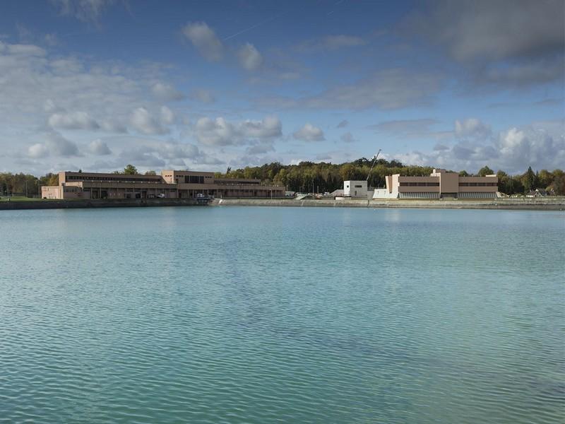
Comment sécuriser la ressource hydrique
Comment sécuriser la ressource hydrique Trois nouveaux axes en phase d’être déployés Priorité au dessalement et au recyclage des eaux usées La rareté de l’eau gagne p
Savoir plus...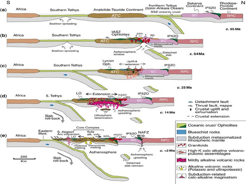
GEODYNAMIC EVOLUTION OF THE PAN-AFRICAN OROGENY
GEODYNAMIC EVOLUTION OF THE PAN-AFRICAN OROGENY Prof. Hervé Rezeau, Prof. Cyril Chelle-Michou & Prof. Michael Calder SEG Student Chapter of Geneva (Switzerlan
Savoir plus...
Cannabis médical : cette « mousse » serait plus efficace que le THC
Cannabis médical : cette « mousse » serait plus efficace que le THC À faible dose, le THC présente un important potentiel thérapeutique. Pourtant, il reste peu utilisé compte tenu des ef
Savoir plus...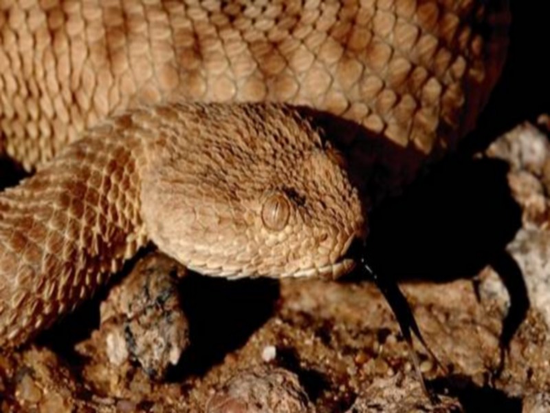
La vipère de l’erg
La vipère de l’erg Cousine de la vipère à cornes, la vipère de l’erg (Cerastes vipera) est présente dans de nombreuses régions du sahara marocain. On la trouve notamment dans les
Savoir plus...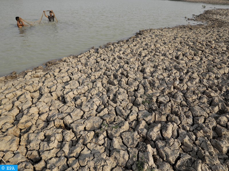
Résilience économique du Pérou face à El Niño : une leçon de gestion climatique inspirée du Territoire soutenable du Géoparc Jbel Bani
Résilience économique du Pérou face à El Niño : une leçon de gestion climatique inspirée du Territoire soutenable du Géoparc Jbel Bani Le phénomène climatique El N
Savoir plus...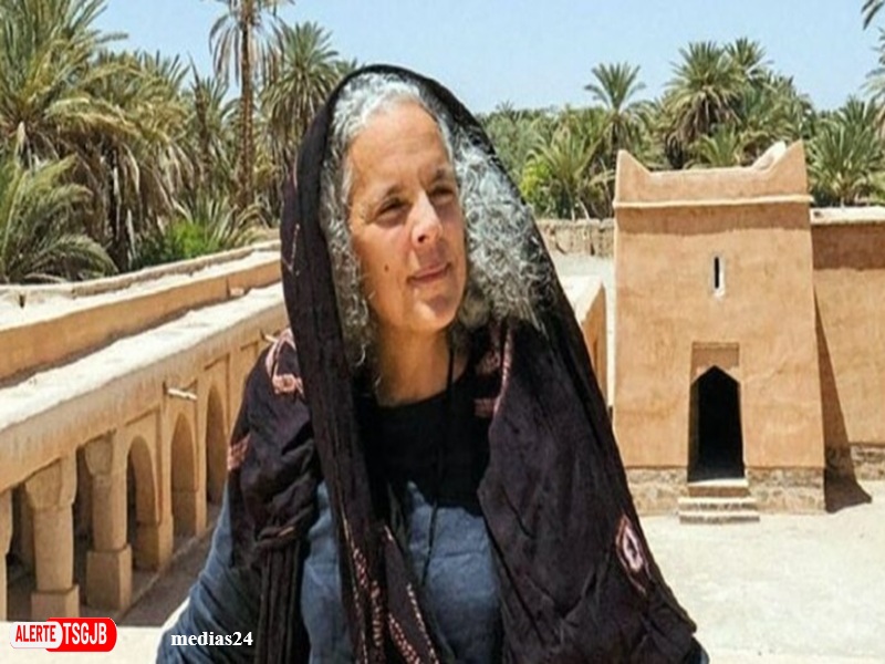
ALERTE TSGJB Salima Naji decoree de la Legion d’honneur pour son engagement en faveur du patrimoine marocain
ALERTE TSGJB Salima Naji decoree de la Legion d’honneur pour son engagement en faveur du patrimoine marocain L’architecte, anthropologue et écrivaine Salima Naji a été nommée chevalier de la L&
Savoir plus...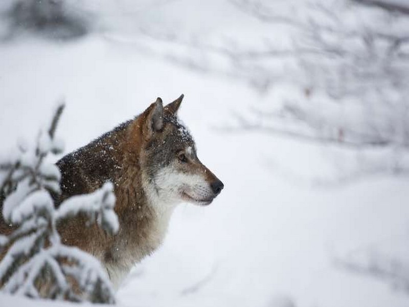
Réintroduction du loup : des bénéfices inattendus pour le parc de Yellowstone
Réintroduction du loup : des bénéfices inattendus pour le parc de Yellowstone Une nouvelle étude a analysé 40 années de recherches sur l'écologie de ce parc naturel aux État
Savoir plus...
CHARTE D'ETHIQUE Géoparc du Jbel Bani
CHARTE D'ETHIQUE Géoparc du Jbel Bani EDITORIAL Le Geoparc est cree a une periode ou le Maroc est en pleine mutation administrative avec la mise en place de la Régionalisation avancee, dans la continuit
Savoir plus...Les tags en relation
En savoir plus sur " Géologie et TSGJB - AMDGJB "
Consulter les vidéos de " Géologie et TSGJB - AMDGJB " Consulter les photos de " Géologie et TSGJB - AMDGJB " Consulter les publications de " Géologie et TSGJB - AMDGJB " Consulter les éditions de " Géologie et TSGJB - AMDGJB " Consulter les communications de " Géologie et TSGJB - AMDGJB "Recherche du site
Recherche avancée / Spécifique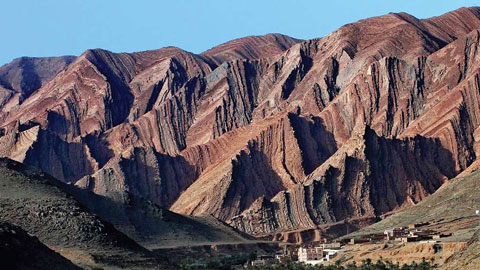
Géoparc et Recherche Scientifique
Le coins de l’étudiant
Blog Géoparc Jbel Bani
Dictionnaire scientifique
Plus de 123.000 mots scientifiques
Les publications
Géo parc Jbel Bani

Circuits & excursions touristiques
cartothéques
Photothéques
Publications & éditions